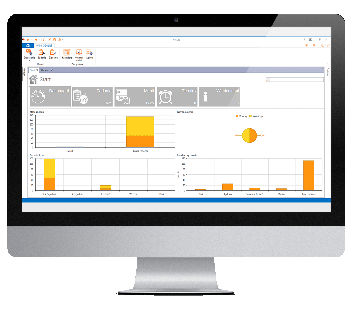
Supervision of the tasks related to technical maintenance primarily includes management of the guarantees and service contracts, schedules of preventive technical inspections, and completing of the required documentation. On the other hand, it is a question of flawless operation of the ‘service desk’ receiving tickets and managing service response. The latter includes management of workloads and timesheets, as well as recording of time and effort dedicated to a given piece of equipment. Running of these procedures within iffmGIS system, allows one to monitor costs, timeliness and completeness of maintenance service, track frequency of faults and repairs, and costs of maintenance of various elements and parts of individual buildings and equipment.
iffmGIS secures automation and facilitation of often complex and time-consuming processes of management of service, technical inspection and guarantees. Key functions:
⦁ Planning and executing of preventive maintenance, repair of infrastructure and equipment,
⦁ Management of the maintenance schedules, creation of maintenance cycles,
⦁ Support of the process: service agreement/crash-reporting/task allocation/service order/repair/invoice/documentation,
⦁ Ticketing – PC and mobile service desk and monitoring of the task execution,
⦁ Precise localization of inventories on the floor plans using bar/QR codes.
⦁ Inventory-taking (mobile)
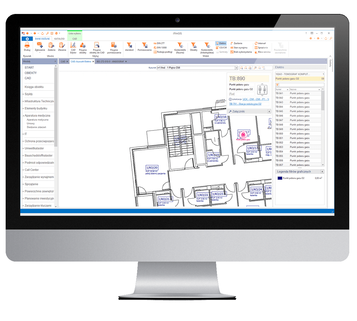
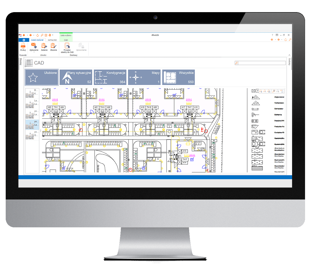
Technical maintenance of buildings, their infrastructure and equipment includes management of utilities, and assuring continuity of their supply (gases, heat, electric power etc.). Data showing points and areas of supply from a given source help to service utilities and improves necessary communication with the users of space and equipment. Extent of use of CAD in the iffmGIS system depends on the needs and processes implemented by the users. iffmGIS does not have any limitations in this regard – it uses its own CAD editor and with a possibility to import .dwg and .dxf drawings with no need to buy a separate Autodesk or other license. However, it is a good practice that the level of detail of CAD and data base information should be optimised: adjusted to the possibility and cost of keeping information up-to-date. Outdated data is useless. The level of detail of stored information strongly depends on actual management processes implemented by the organization supported by the iffmGIS system.